Remote Sensing and Ecosystem Structure
Most ecological measurements flatten 3D ecosystems into 2D maps. We use lidar and drones to capture the full spatial structure of forests, outcrops, and landscapes.
Most ecological and biogeochemical measurements are two-dimensional: maps, transects, point samples. But ecosystems are three-dimensional. The arrangement of canopies, gaps, and understory in a forest determines light availability, microclimate, and carbon storage. We use drone-mounted lidar, terrestrial laser scanning, multispectral imaging, and satellite data to capture that 3D structure and help us understand how biogeochemistry works.
3D forest structure
One approach is to pair high-resolution lidar with long-term forest inventory data to connect the physical architecture of a forest stand to what’s actually happening ecologically. How does canopy arrangement affect growth rates? Where does mortality cluster? What does the 3D structure tell you about carbon storage that a flat map can’t?
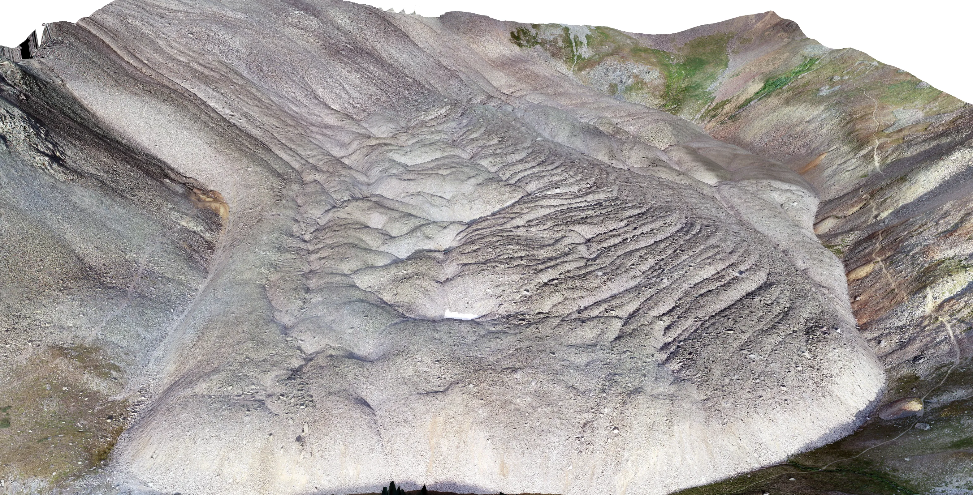
Drone photogrammetry
We fly drones and process the imagery into orthomosaics and 3D surface models. We’ve used this for mapping carbonate distributions at high-altitude lakes, surveying rock outcrops, and documenting archaeological sites.
Lidar across scales
Lidar gives you a 3D point cloud of whatever you scan. We’ve applied it to forests, outcrops, buildings, and archaeological sites at places like Johnson’s Shut-Ins, Shaw Nature Reserve, Cahokia Mounds, and Tyson Research Center, and worked with partners to collect data on several continents.
Scaling up
The ground-level structural data we collect calibrates and validates satellite estimates of forest biomass and ecosystem complexity. That’s the bridge between a detailed local scan and a global carbon map.
Cloud computing and large-scale data
More and more of this work happens in the cloud. We run analyses on Microsoft Planetary Computer and Google Earth Engine because the datasets are too big to deal with on a laptop. On the geochemistry side, we pull from PetDB and GEOROC — community databases where decades of published rock and mineral analyses are all in one place. Having everything accessible like this means you can do things that used to be separate projects in a single analysis, like matching a global rock chemistry compilation against satellite land-cover data to see what jumps out.